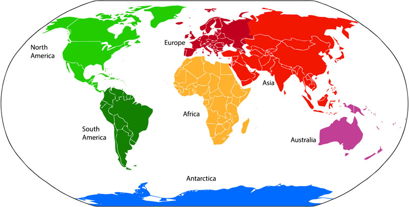
 Continents are large masses of continuous land above sea level. The land surface of our Earth has been divided into seven continents; Asia, Africa, North America, South America, Europe, Australia, and Antarctica. Geographically, each continent is divided into many countries, for example, Asian Continent has 48 recognized countries by United Nation.
How Continents Are Divided?
Our Earth has been divided into seven continents geographically. These seven continents are not divided based on the pure scientific definition. For example, it is assumed that our 7 recognized continents are distinct masses of land. But in reality, only Antarctica and Austria are the only separated land masses. Other continents are somehow connected e.g. Asia is connected with Africa by a 125 km wide land bridge called the Isthmus of Suez.
Furthermore, Europe and Asia are a single largest landmass called Eurasia. But still, they are recognized as separate continents by cultural and language differences. If we strictly follow the distinct landmasses definition of continents. Then we will be left with only four continents which are Afro-Eurasia, America, Australia, and Antarctica.
Microcontinents
Many Islands and other small distinct landmasses that are too small to be recognized as continents are called microcontinents. These are the fragments of ancient large continents, also called supercontinents, from which present-day continents are formed. Madagascar is one of the famous microcontinents.
Subcontinents
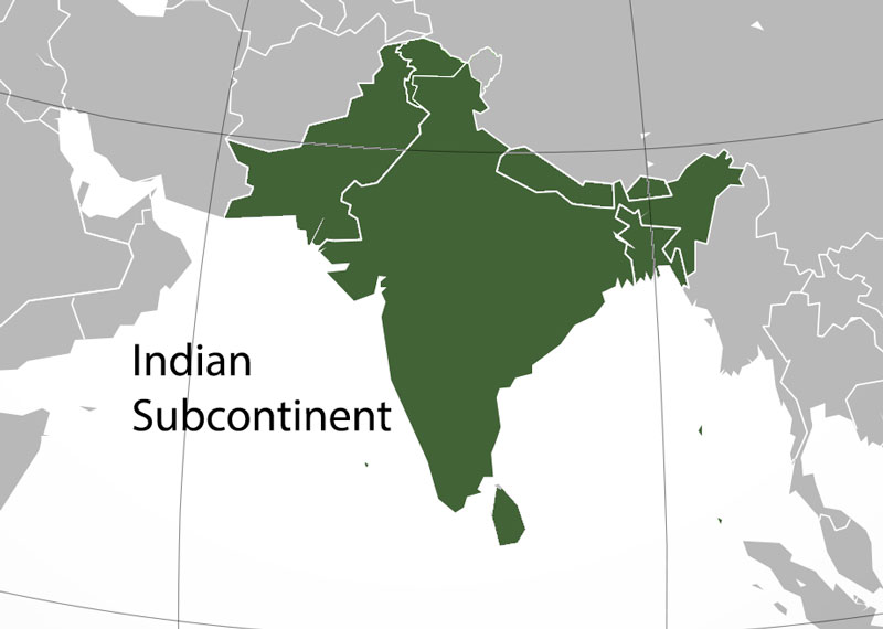
Main continents are often subdivided into subcontinents. For example, Asia is divided into the Indian subcontinent, Arabian Peninsula, Indochinese Peninsula, Japanese archipelago, and Maritime Southeast Asia. In many cases, subcontinents often lie on different tectonic plates than their parent continent. America, as a single continent, is subdivided into North America, South America, and Central America subcontinents.
How Continents Were Formed?
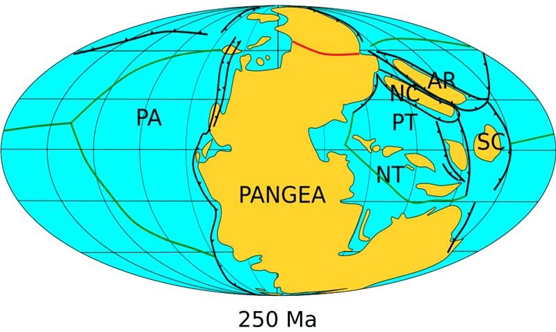
The surface of the Earth (including the land and oceanic floor) is composed of many pieces that are joined together like a jigsaw puzzle that floats on the mantle layer of the Earth. These pieces are called Plate Tectonics which are under constant movement since the formation of the Earth. The present-day continents, as seen today, were not in the same place and shape in the past. The position, size, and shape of these continents have been changing due to plate tectonics activity.
Around 480 million years ago, the Earth had many distinct continents that were mostly scattered south of the Equator. But 240 million years ago, all these continents were merged and formed a large chunk of land called the Pangaea Supercontinent. Around 40 million years later, the Pangaea began to break apart due to plate tectonic activities. This was the beginning of the formation of the modern continents that we see today. In the next 200 million years, the continents were shaped and placed where you see them on the map.
The development of continents is not stopped yet, they are still moving at the speed of 2 cm per year. If you fast forwards the time, you will see California will be detached from North America and will become an island.
Interesting Facts
- The word Continent land means continuous land was translated from the Latin words terra continens. Also, the word continent land means a connected land.
- Asia is the most populous and largest continent in size.
- Africa is on the top of the list by the number of countries. It has around 54 countries including South Africa, Egypt, Sudan, Nigeria, and Somalia.